The Aran Islands
The Aran Islands stretch across the mouth of Galway Bay, guarding it from the wide Atlantic Ocean beyond. There are three Islands stretched in a chain across the mouth of the wide bay: Inis Mór, the 'Great Island', Inis Mean, the 'Middle Island' and Inis Oir the 'Small Island'. The islands are composed of limestone and are closely related to land on the east side of Lough Corrib and the nearby mountains of the Burren in Co Clare. It has been said that the hills of Clare were once connected outer and elder lands which have since fallen under the sea. Indeed, some claim that Ireland was once joined to a part of Atlantis.
Whatever about Atlantis (for more information on this subject read Ireland: A Journey Into Lost Time by P.A. Ó Síochán), the oldest remains on the islands are six wedge monuments dating to the late neolithic period, perhaps about 2,500 BC. I say perhaps because there are not many dates from excavations in Ireland, so much categorization is really well educated guess work. We can say for sure that the landscape around Galway Bay was inhabited earlier: a mesolithic axe head was found near Oughterard to the north, and there are sites all around the areafrom the neolithic like the massive cairns around Cong and dolmen near Menlo.
There are three wedges on the big island, two on the middle island and one on Inis Oirr.
The neolithic settlers would have arrived from the mainland in skin covered boats called curraghs, which are still in use today on the islands. These early inhabitants would have brought animals with them, and probably lived near their wedge monuments. Research in the nearby Burren has found that wedges were linked to territorial tribal agricultural areas. None of the Aran megaliths have been excavated.
Dun Aonghus
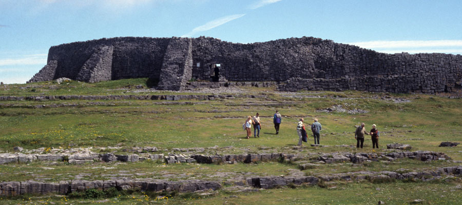
One of the most spectacular monuments on the west coast of Ireland must be Dun Aonghus. As Thomas Westropp said in 1910:
Irish mythology and folklore suggest that the great forts were the homes of the ousted Fir Bolg tribes after their defeat by the Tuatha De Danann after the First Battle of Moytura. Aonghus was said to have been a leading Fir Bolg chieftain.
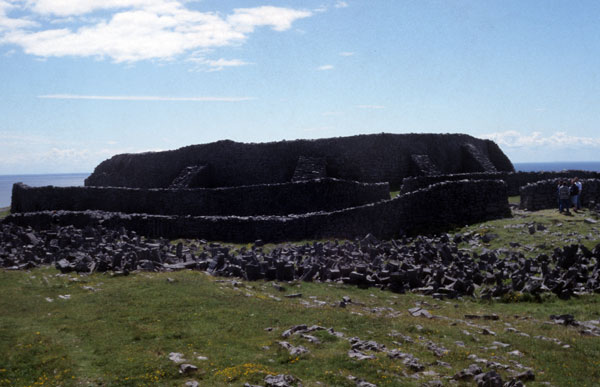
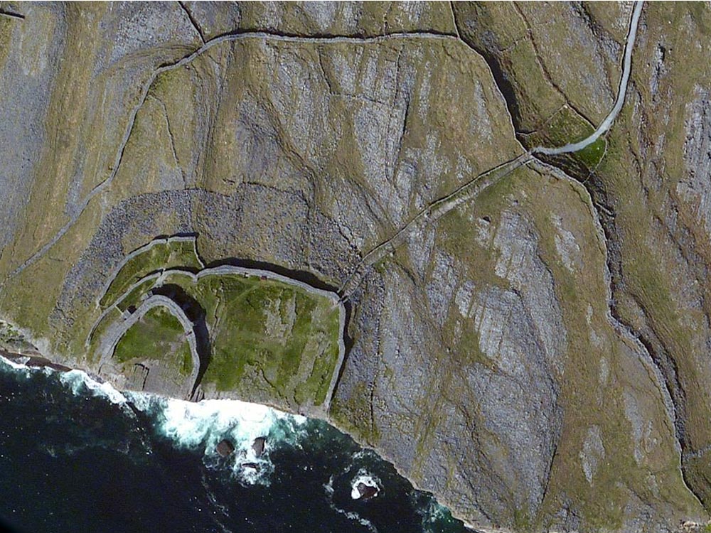
The earliest phases of this massive construction dates back to the late Bronze age, around 900 BC. The site was partially excavated in the early 1990's, and evidence of extensive settlement and weapon manifacture were found within the walls. It is thought to have been the home of the leader of a powerful tribe. It has been suggested in the past that the missing part of the fort had fallen into the sea. However, it is more likely that the fort is positioned to watch over both the sea routes and a good portion of the island.
The fort was extensively expanded in the early Medieval period, when the walls were added to and extended. The great wall for which the fort is best known were added at this stage. It is uo to 6 meters wide in places, and 5 meters high. There are stairways built into the inner surface, and two terraces running around the interior. At this time, the fort was probably home to a chieftain who either made a lot of wealth from shipping and trade: the forts guard the mouth of Galway Bay, and so control the sea routes. It is not unlikely that they were pirates!
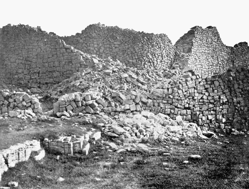
Dun Aonghus was a powerful symbol of ancient Ireland, and the walls were restored sometime after 1880 when the five massive buttresses were added to the outside of the great wall. The great fort is the most popular tourist destination on Inish Mor, attracting up to 1000 visitors a day during the tourist season. Well worth a visit.
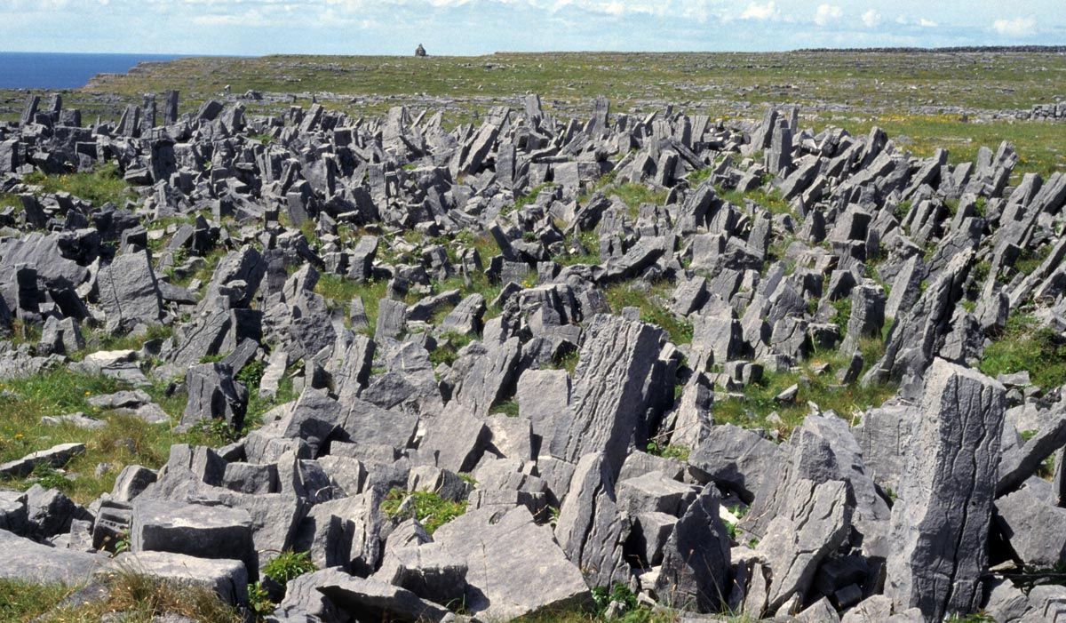
Around Dun Aonghus is found a great limestone defensive feature known as a chevaux de frise. This feature is composed of jagged upright limestone slabs, some almost two meters tall. They are spread around the area outside the original fort in a band that is 25 meters wide at the thickest portion on the north side of the fort.

