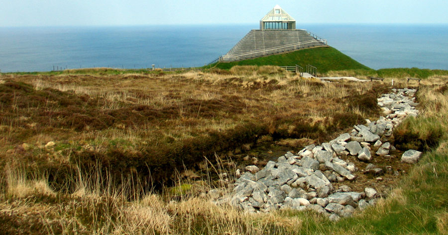
Banner: Knocknarea sunset
A large circular neolithic enclosure at the Ceide Fields.
A large circular enclosure at the Ceide Fields in County Mayo. This structure is suggested to have been used as a pen for cows with young calves. Views from here are breathtaking: out across sea cliffs onto the Atlantic ocean.

The Céide Fields

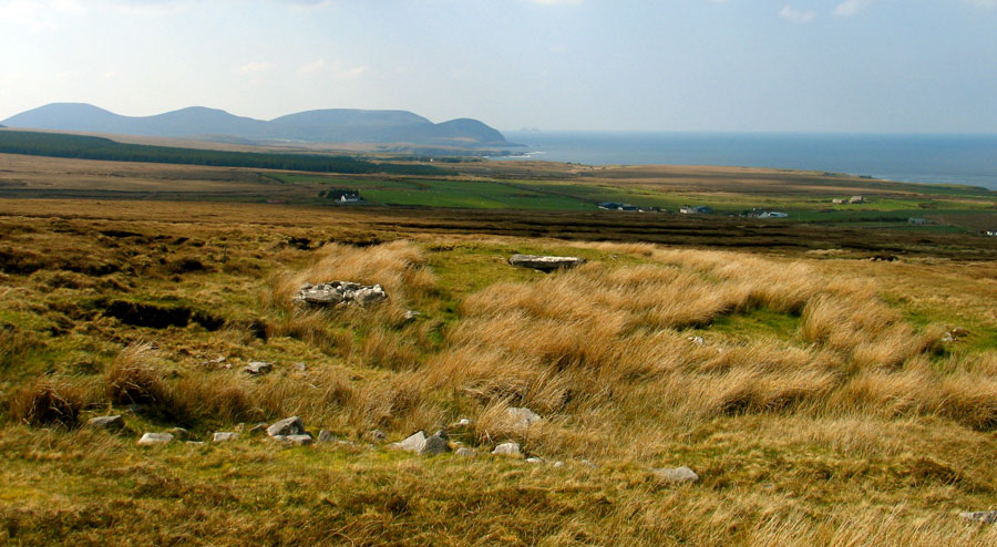
Situated on the north coast of County Mayo, the Céide Fields offers a glimpse of the life of early farming communities in Ireland stretching from the neolithic through to the bronze age.

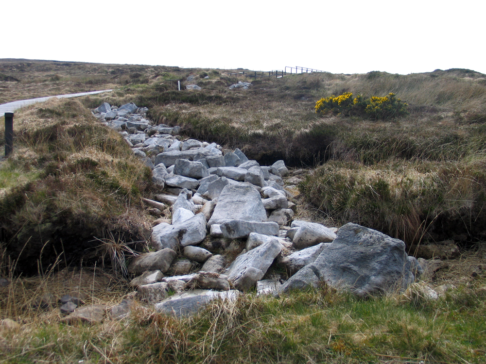
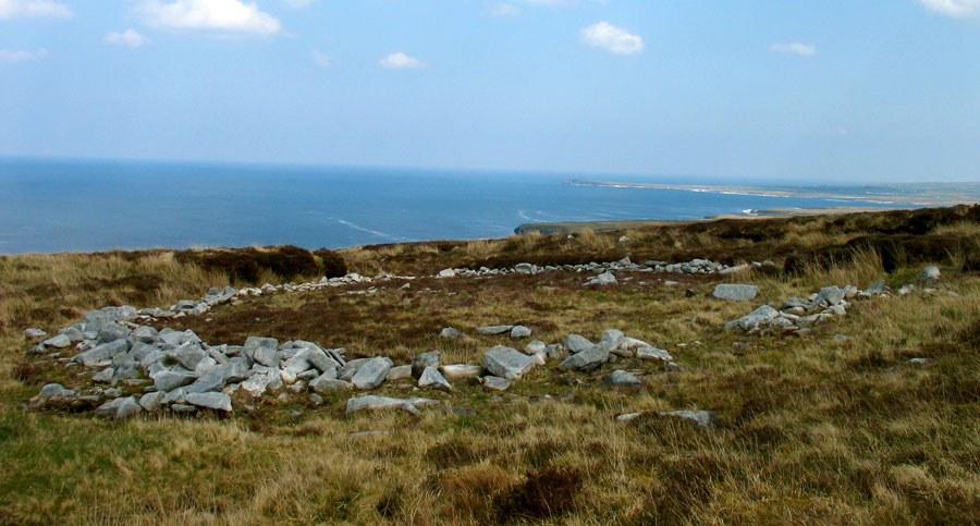
The site consists of an extensive set of field systems, considered by some to date to the bronze age, with associated hut sites and enclosures, and surrounded by a cluster of impressive neolithic court-cairns.

Céide Fields - History on our doorstep.

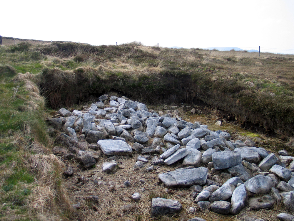
Though the main concentration of field systems are found at Céide, as well as a scattering of other monuments, they stretch for several miles east and west. More walls and monuments have been found on the hill of Rathlackan some 12 kilometers east of Céide, while monuments, fields and dwelling sites have been found at Belderg a few kilometers west of Céide.

Excavated section of collapsed wall at Céide.

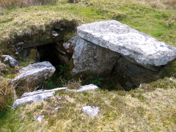
The picture presented today is that neolithic colonists farmed the land here, planting crops such as barley and emmer wheat, and kept cattle and sheep as their livestock. The main type of monument found in the area are neolithic court-cairns, though there are two probable passage-graves on the long ridge of Sreeloga Hill close by.

Several court-cairns are scattered across the Céide Fields. For many years, these were considered to be the oldest type of megalithic monument in Ireland, but more recent research on the Sligo passage-graves has shown that the courts may be contemporary or slightly younger than the passage-graves. The causewayed enclosure at Magheraboy in Sligo is currently the oldest dated neolithic monument in Ireland.

A fine example of bog pine at the Ceide Fields Visitor Centre.

This presents an interesting picture when one looks at the mythology of the region, which deals with two tribes, the Formorians and the Túatha Dé Danann. The myth of the Second Battle of Moytura tells of two competing groups of farmers who arrive in Ireland, which is not uninhabited, but peopled by a tribe called the Firbolg.

We now believe, based on aDNA evidence, that the builders of Irish neolithic court-cairns originated in Anatolia some 10,000 years ago. The original farmers spread out in search of land. One group migrated through the Mediterranean, spreading the new religion of farming, eventually reaching Spain and France about 7,500 years ago. The other group, called the  Bandkeramik people, migrate overland up through the Balkans, following the course of rivers such as the Danube. They also flood into France in great numbers.

It seems that overcrowding and competition for land and resources lead both the Bandkeramik and Passage-grave people to spearhead the colonisation of the large islands to the north.

The court cairn at Behy.
The court cairn at Behy, beside the Ceide Fields. The monument, which was excavated in the 1960's, has been reclaimed by the bog and can be hard to locate. This site has fantastic views out across the Atlantic. The Stags of Broadhaven, two pyramidal rocks jutting out of the ocean are visible on the horizon.

The Céide walls

The walls that brought the Céide Fields to light were preserved by the growth of bog across the prehistoric landscape. As the climate changed, about 3,500 years ago the land became wetter and harder to farm, until the bog took hold and began to grow. Over the intervening span of time, plant and moss fibers decomposing built up the layers of peat, smothering the stone walls. The fields were rediscovered by modern farmers cutting turf, the traditional fuel in the west of Ireland. For years they had been coming across tumbled stone walls and sometimes quernstones. Archeologists in the area developed a technique of probing the bogs withlong metal probing rods, which enabeled them to map the wall systems without excavating them.

Downpatrick Head.
A section of exposed wall at Ceide.

The Visitor Centre

A large visitor centre was built at Ceide in 1994, which provides a good base from which to visit the windswept landscape. It is perched on the cliffs, located outside the north edge of a field. The centre is built in the form of a pyramid, with bog growing up the sides, and a glass viewing top, so is easy enough to find.

The chamber of Behy court cairn.
The chamber of Behy court cairn. This fine monument was excavated in the 1960's, but has since largely been reclaimed by the bog.

There are many, many monuments in the area, mostly court cairns. In Behy, just a few hundred meters up the bog behind the visitor centre, is a partally covered court-cairn, the chamber of which you can enter. Watch out for the vicious Céide midges, though! This is a fine example of a transseptal (cross-shaped) chamber, one of only 8 found so far in Irish court cairns.

Downpatrick Head.
Downpatrick Head, the place where, according to legend St Patrick banished all the snakes from Ireland. The sea stack, Dun Briste (the Broken Fort) has an ancient habitation site on its summit. The foundations of a house and two barrows can be seen at the top of the picture.

Another famous monument - at least to archaeologists - is the Ballyglass court cairn. When this monument was excavated, the site of a rectangular house was discovered beneath the monument. A reconstruction of this dwelling can be viewed in the visitor centre.

The pyramid-shaped visitor centre at the Ceide Fields.
The pyramid-shaped visitor centre at the Ceide Fields, with one of the tumbled field walls to the right.