The structures described in this report are situated on an area comprising part of seven townlands, called respectively Tully ("mound"), Trian Scrabbagh ("rugged third"), Ceathramhadh Caol ("narrow quarter"), Mullach Fearna ("summit of the alder," also, and I suspect more correctly, called Mullach Borna, "summit of barley"), Dun na bhFioradh ("fortress of the ridges"), and the East and West Carraig na hEorna ("rock of the barley"). The Anglicized spelling of these simple words is of the usual ugly and cumbrous appearance: both forms will be found marked on the map.
This map has been designed and drawn in a form meant to show as clearly as possible, to a reader unfamiliar with the ground, its remarkable character. The summits are left white, the long, straight valleys being deeply shaded. The precipitous walls of rock which line the valleys for the greater part of their length are marked by specially shaded lines which are easily distinguished.
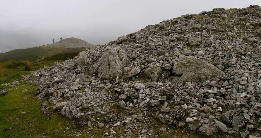
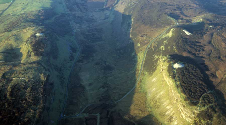
The 1911 map of Carrowkeel.
Each of the ridges and the valleys between them have names. The name of the furthest ridge, on which Carn A stands, we did not obtain, nor yet that of the valley which runs to the east of it.
The next is called Howley's Rocks, from a former owner, though it is now being named Gorman's Rocks, after its present proprietor. This phenomenon of the change of a geographical name with a change of owner is known to occur elsewhere in Ireland.
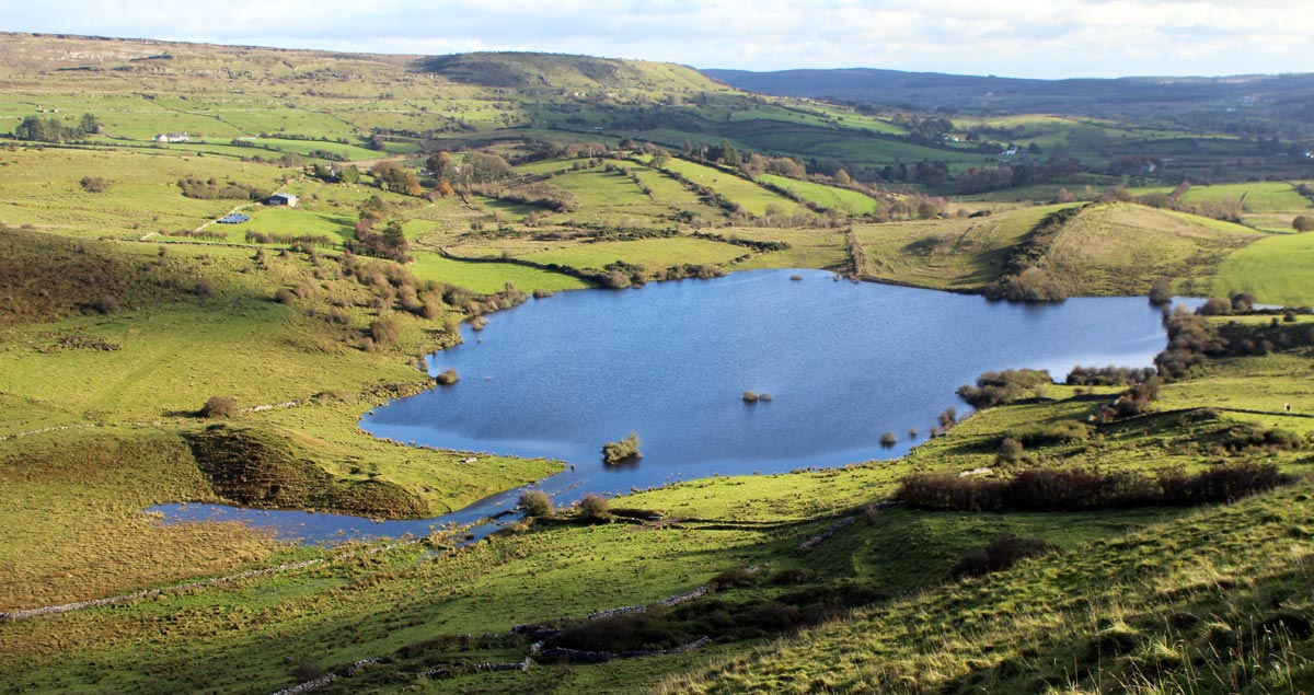
The wide valley to the east of Gorman's Rocks is called "Shroich," which is a name we cannot explain with any certainty. At the lower end of this valley is a tarn in the bog, known as "Lough Availe." Possibly this is meant for Loch Aidhbhil, the "vast" or ‘terrible" loch, a name wholly unsuitable for this quiet little sheet of water, notwithstanding a "water-horse" traditionally said to haunt its depths. Round this lake the valley assumes the name of "Shroich Availe."
A boulder in the bottom of the valley, quite natural, is called " the old gate by the local people. The next ridge, on which stands the important carns E and F, is still called Carn Mor (carn being here always pronounced corran); but in English, which is usurping the place of Irish in this place-name, it is called "Big Carns," in the plural.
The next ridge, on which the smaller carns stand, is always called "Little Carns," the Irish name being lost. Between these two ridges is a long, narrow, and cliff-walled valley, called "Keeleoon," that is Cadi Cuan, "the narrow inlet" a very suitable name.
The low-lying boggy tract at the mouth of this valley is called Loch a Bhaithte, pronounced "Lough Awatia" (the last word rhyming exactly with "caught ye"). It is now dry, except after rains, when a little water stands in the hollows. Professor MacNeill has suggested, in conversation, that the name ("Lake of the Drowning") might indicate that the death penalty by drowning had been inflicted here. There are several springs hereabout.
Lough Gowra, a beautiful mountain lake between Carrowkeel and Kesh Corran.
Poll na gColum
On the ridge of "Little Carns" is a huge and picturesque swallow-hole, which we explored without any result of special interest, known as Poll na gColum "the hole of the pigeons", though, strange to say an idea seems to have got abroad in the district that the name means hole of the foxes." It must be admitted that the latter is amore suitable name.
A broad shelf on the east side of this ridge, above one precipice and below another, is called Bothar na Beinne, "the way of the hill-top " this is possibly a tradition of a road followed by the ancient inhabitants. It is not a natural way to follow, but that is not a conclusive objection: there might have been a ritual significance in the road. The precipice below this "road "is called Caiseal "Castle."
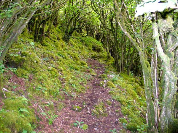
A pathway leads up the side of Carrowkeel mountain, through a thicket of hazel, across the valley to Doonaveeragh.
The next valley is called "Upper Clar," a curious mixture of English and Irish: it means "Upper table," i.e. "Upper flat land."
In the precipice that bounds this valley on the western side, a short distance north of the mearing between Ceathramhadh Caol and Mullach Fearna townlands, is a curious rift in the rock, which gives easy access to the top of the precipice. It is about fifty-six feet in length, and perhaps on an average five feet wide: the cliff bounds it on the west, and a great isolated wall of rock forms its eastern wall. It is locally called Boithin an tSagairt, “the priest's hut," and probably was used during the penal times as a hiding-place for some priest, a purpose which it would well serve, being out of the line of traffic, and quite invisible to anyone not acquainted with the district.
The Irish name is being lost, More likely, however, it may be simply Loch an Beal, the lake of the (valley) mouth, as Mr. O'Klaffe has suggested to us. however, and an incorrect English name, "the priest's grave" substituted to explain which a story about Cromwell shooting a priest and burying him here has evolved itself. A small pile of stones, lying apparently directly on the rock, in a recess just inside the lower entrance to the passage and on the eastern side, is pointed out as the "grave".
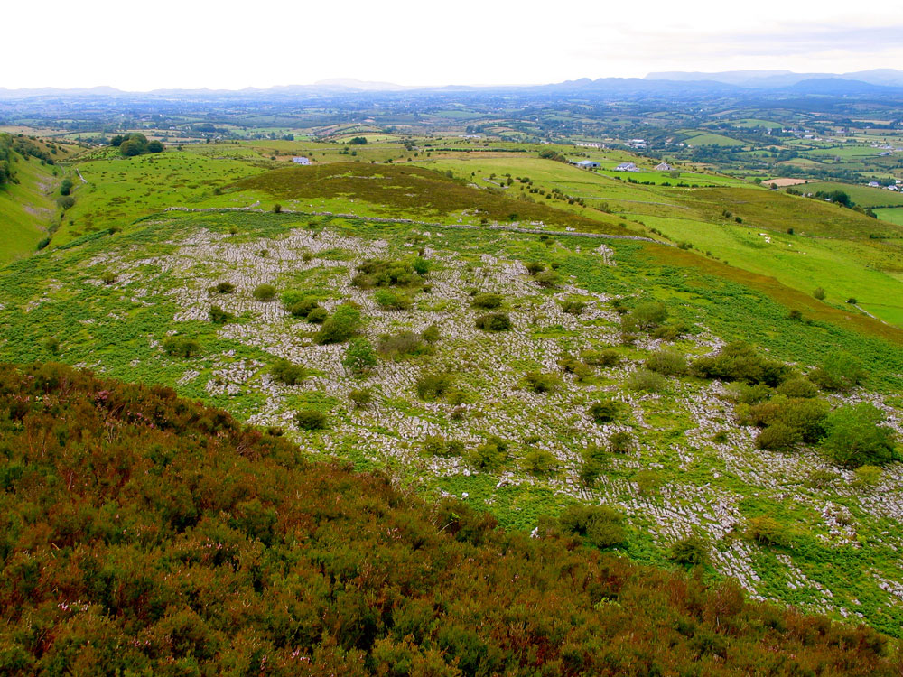
The eastern-most spur consists of two parts, the towering crest of Dun na bhFioradh and the flat table-land on which stands the settlement to be described, called Corr Logach, "the hollowy hill," or Clar Corrach, "the marshy (or level) table-land." In the valleys there is nothing of archaeological interest to be seen. On the ridges are the following:
I. Fourteen burial carns.
II. Two ruined dolmens, or dolmen-like structures.
III. A group of circular enclosures, apparently the remains of an ancient village.
It may here be stated that of the carns only three (C, G, and H) are recorded as such on the Ordnance Map, and none of the other structures; and that of the twenty-three place-names in the square mile of country mapped, only nine ( the seven townland names and two others, all in phonetic spelling ) are recorded.
Nothing could more clearly indicate the absolute necessity, for scientific or historical purposes, of a thorough re-survey, under expert superintendence, of the archaeology and the fast-corrupting place-names of the country. We now proceed to a description of the structures.
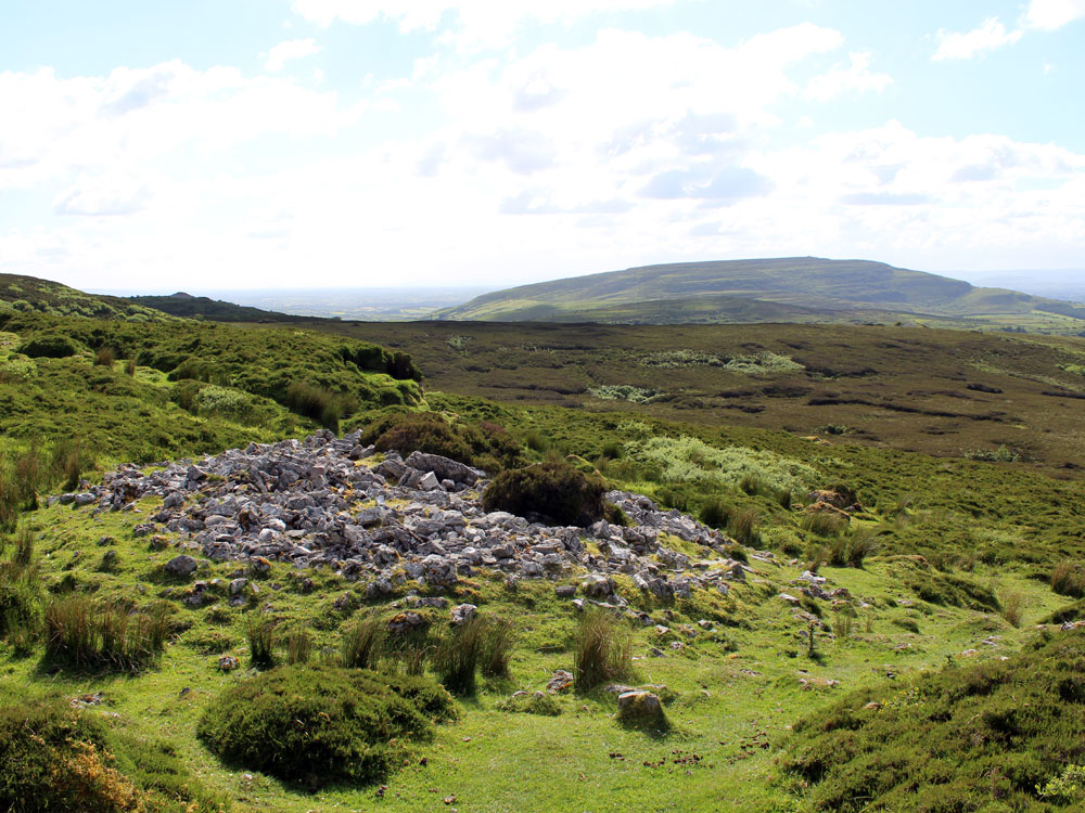
The typical carns are conical mounds of stone, erected on a base more or less circular. They are composed entirely of the limestone native to the spot, save for occasional fragments of calcite, or of the erratic blocks of sand stone that are strewn about in the neighbourhood. The only earth in the carns is a little peat which has evidently been blown over them as dust, and then been washed by rain into the interstices between the stones.
Except in the case of two or three of the carns, very little vegetation has found root them. The internal structure, as will be seen from the detailed description that upon follows, is not uniform. In the concluding summary the various types are enumerated. As at Brugh na Boinne, The chambers are never centred exactly in the heart of the mound, but are rather to one side.
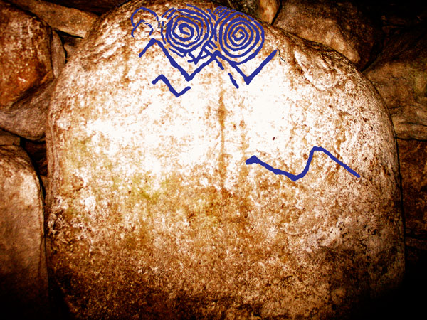
Neolithic art was discovered in Cairn B at Carrowkeel for the first time in 2009.
Once for all we may here state that although we searched for sculptured ornament, such as is to be seen at Brugh na Boinne, with the most scrupulous care, not a single decorated stone came to light anywhere, either outside or inside the carns. The carns are denoted by letters in order from A to P (excluding the letters I, J, which are inconveniently apt to be confused with numerals): they are taken from north to south on each of the ridges in turn, beginning with the most westerly.
It is devoutly to be wished that the pointless modern label of this structure ( "Newgrange" ) should be abandoned in favour of its ancient Irish name.