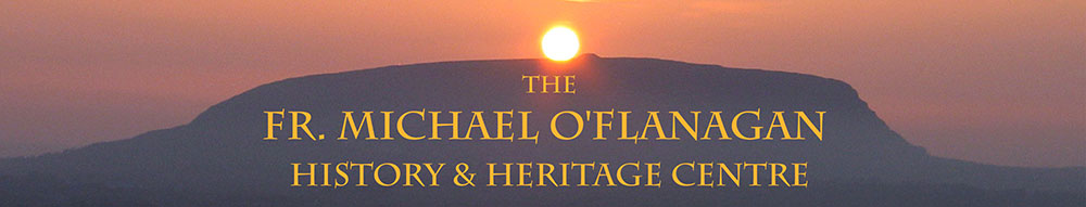
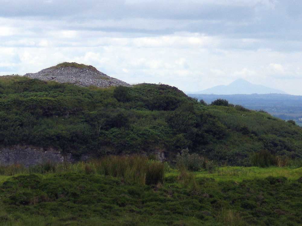
The view to the west from Cairn F. The triangular profile of Croagh Patrick can clearly be seen 75 kilometers distant in County Mayo.
The Panorama from Carrowkeel
On a clear day, looking out from their interiors, one encounters a magnificently extensive view—all the lake-dotted fertile plain of southern Sligo, east Mayo and Roscommon, and the Mayo highlands down to Achill, Croagh Patrick, and Maamtrasna, with Lough Mask and Lough Corrib gleaming in the distance. To the cave-diggers, the swift change of view from the dimly-lighted gallleries to the glorious prospect that lay framed by the mouths of the caverns, was a never-ending source of delight.
The Exploration of the Caves of Kesh, County Sligo.
Irish passage-graves are often located in places of extreme beauty and are known for their remarkable views. From the summit of Carrowkeel the views—almost too much to comprehend—are truly majestic: an enormous panorama overlooking large portions of the fantastic glacially-formed landscape of Connaught.
Looking
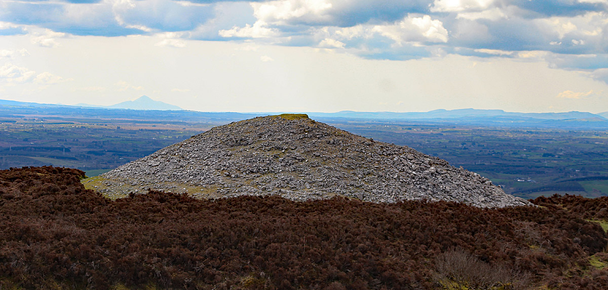
north across Cairn C, The Leprechaun's House, from Cairn E at Carrowkeel. The Ballygawley peaks and Benbulben form a distinctive horizon.
Beginning to the north one can see Knocknarea Mountain, with Queen Maeve's cairn clearly visible on the flat summit. Benbulben, Kings Mountain and the Glens
of Leitrim form a backdrop to the Plain of Sligo. Knocknarea is ringed by the chain of the Ox Mountains and
on Slieve Da Eán the bumps of
three of the four cairns can be made out, with two more on the peaks
of Doomore and Croghan.
The Ox Mountains form the southern chain about the great centre at Carrowmore, the remains of one of the largest ancient sites in Europe.
Looking
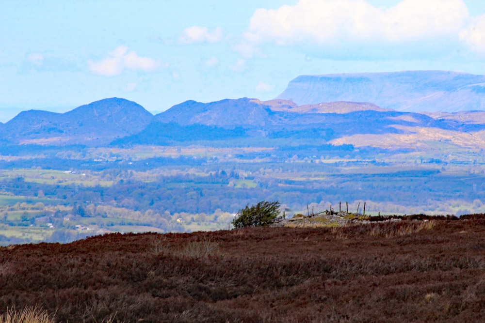
north across Cairn E to Queen Maeve's cairn on Knocknarea Mountain.
To the east is Lough Arrow, a magical spring-fed glacial lake of extreme beauty shaped like a gigantic arrow-head. At the head of the lake, where the River Uinshin flows out to the north, the largest passage-grave in the area, Heapstown cairn can be seen within a ring of trees, on the east bank of the river.
Moytura
Beyond the Lough Arrow looms the low green hill of Moytura with a passage-grave called Shee Lugh
on the highest point. This is the legendary site of the Second Battle of Moytura where the the Tuatha Dé Danann fought the Formorians for the possession of Ireland, a myth that may well be a memory of conflict between conflicting groups of neolithic farmers in the middle of the fourth millenium BC. Beyond Moytura lie
the Arigna Mountains, and farther again lies Sliabh an Iariann, the Iron
Mountain, one of the places where the Tuatha
Dé Danann are reputed to have landed in Ireland.
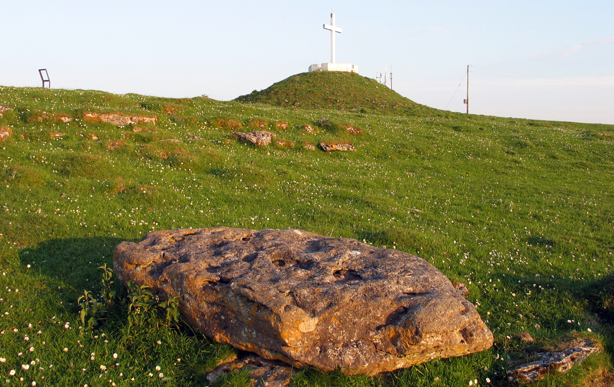
Sheemore, the Great Fairy Hill in Co. Leitrim, looking northwest to Knocknarea.
To the southeast the viewer can see Sheemore,
a small table top fairy-hill rising from the plain, with three passage-graves on its summit The central
monument on Sheemor is crowned with an ugly modern Christian crucifix which is sometimes illuminated at night. A line drawn on a map from Kesh Cairn crosses Treanmor cairn, Treanmacmurtagh cairn through Cairn E, Cairn K and Cairn
P in Carrowkeel, and extends towards the central cairn of Sheemore.
The view of Cairn O at Carrowkeel and the lands beyond the east shores of Lough Arrow.
A Chain of Cairns.
There are several more
examples of large-scale alignments that link passage-graves and complexes in a chain across
the country. These links are being supported by modern research using Ancient DNA, which has linked Carrowkeel with Carrowmore, and people buried in both complexes were related to individuals in Newgrange and Millin Bay.
The web of links through Ancient DNA connecting Listoghil at Carrowmore to Carrowkeel, Millin Bay and Newgrange, explained by guide Pádriag Meehan at Carrowmore.
Moving clockwise across the beautiful Lough Key the viewer can see Corn
Hill (or Cairns Hill) in Longford, where two neolithic cairns, probably passage-graves are built close to the summit, somewhat damaged by a radio mast.
The
large quartz pillar west of Cairn D. Jean McMann suggests it may have
been quarried nearby, as there are veins of quartzite in the rock of Cairnbane
West.
Loughcrew
Seventy-five kilometers from Carrowkeel, beyond Corn Hill, is the next great megalithic complex at Sliabh na Cailleach, the Mountains of the Hag at Loughcrew, close to Oldcastle in County Meath. On the west hill at Loughcrew a broken two metre quartz pillar was discovered close to the largest passage-grave, Cairn D. From this location on the
highest and most westerly part of Loughcrew, the Arigna Mountains east of Lough Arrow are visible. Is it possible that the quartz pillar would have been visible from Carrowkeel at sunset as the suns rays lit it up?
To the south of Carrowkeel lies the sandstone peaks of the Curlew Mountains—the Rough Mountains—a formidable natural barrier which separates Sligo from Roscommon. To the south-west is Lough Gara, a large body of water densely populated in mesolithic times. Beyond Lough Gara stretch the fertile plains of Roscommon, to Rathcroghan, the capital of Ancient
Connaught and home of Queen Maeve.
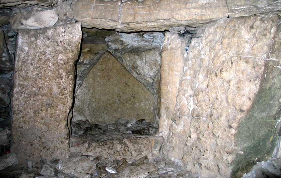
The Croagh Patrick Stone, right-hand recess, Cairn K.
On clear days to the south-west the Mweelrea range in south Mayo are visible,
down as far as Lough Corrib and the plains of Galway, where Fionnavar's
mountain Palace Knockma and the ancient sites at Cong are located.
The Croagh Patrick Stone
Out to the West beyond the Bricklieve Mountains, two peaks stand out on the horizon. Nephin Mountain and Croagh Patrick are both clearly visible from the top of Carrowkeel. That Croagh Patrick was of special significance to the Carrowkeel people is demonstrated by the presence of a carefully-shaped and positioned stone within Cairn K.
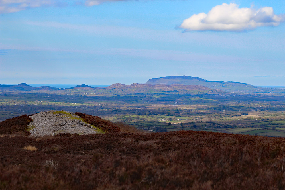
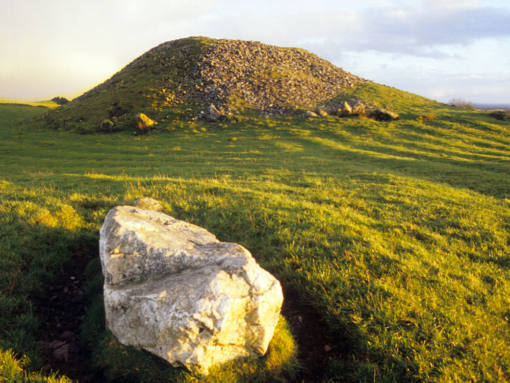
The view from Carrowkeel across Cairn B to Croagh Patrick seventy-five kilometers to the west.
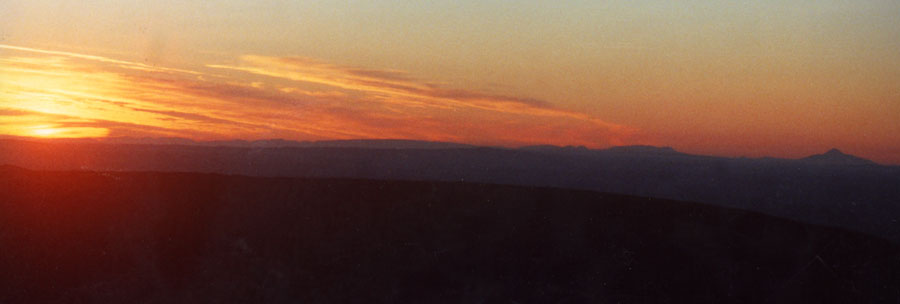
As the sun sets on the Samhain and Imbolc cross-quarterdays in early November and Febuary, the observer in Carrowleel will see the solar orb drop behind Croagh Patrick when viewed from Cairn K. This axis and event is commenorated in the Croagh Patrick stone within the cairn.
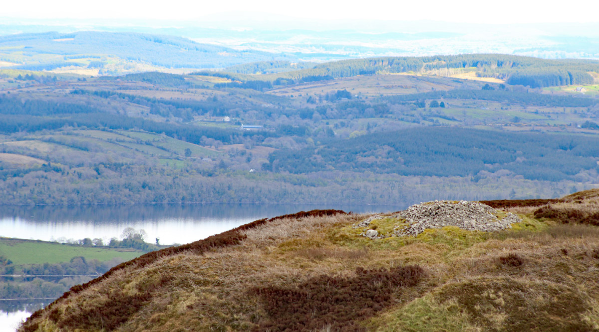
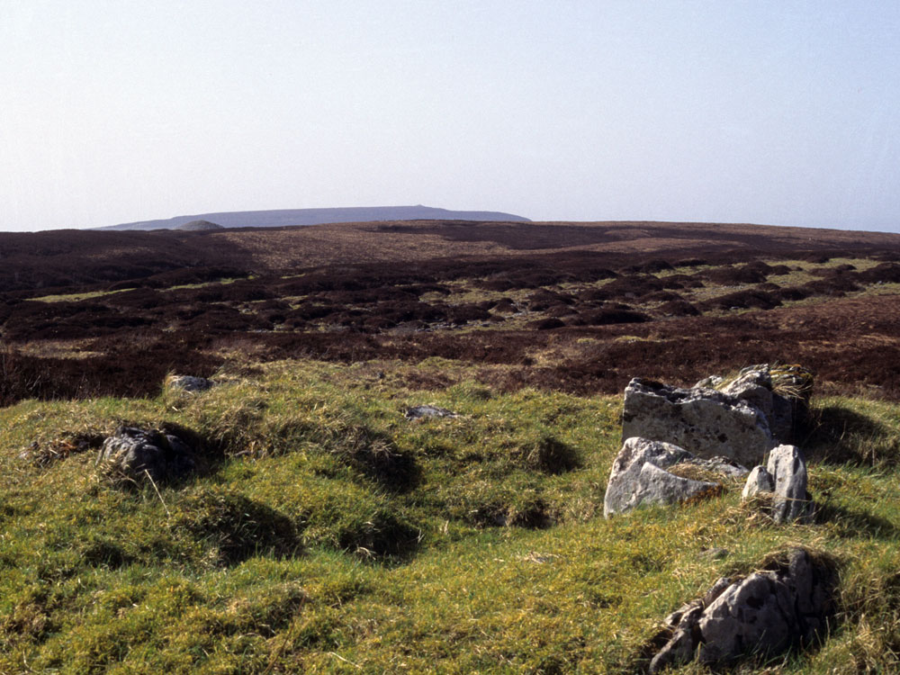
Alignment from the ruined chamber of Cairn N. The orientation is to Kesh Cairn on the summit of Kesh Corran.
Finally the mystical bulk of Kesh Corran looms in the west, dominating the skyline from Carrowkeel with its great
cairn, The Pinnacle on the highest part of its long, flat summit.
Beyond Kesh Corran to the north-west is Knocknashee, a 300 meter tabletop mountain with two cairns and the remains of an ancient village of thirty house foundations,
framed against the background of the Ox Mountains.