Banner: Knocknarea at Sunset.
Looking across Mullaghafarna plateau from the east edge of Carrowkeel.
Looking across Mullaghafarna plateau from the east edge of Carrowkeel. Many of the hut circles are clearly visible in the evening sunlight. Beyond is Moytura, Carran Hill and Siabh an Iariann.

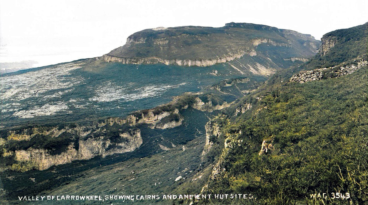
Doonaveeragh Neolithic Village

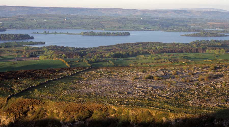
The plateau of Mullaghafarna on the northern end of Doonaveeragh Mountain is best viewed from the edge of the east terraces on Carrowkeel Mountain, which offer breathtaking vistas across Lough Arrow and Moytura. The plateau land is privately owned, so you seek the owner's permission to visit.

Aerial
            view of the Doonaveeragh.
Aerial view of the Doonaveeragh house sites. Image © National Monuments Service.

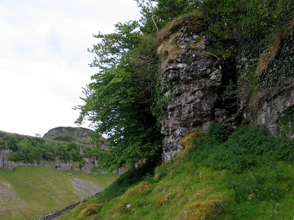
The narrow valley between Carrowkeel and Doonaveeragh, is an amazing geological formation that gives the place its nome: "the Narrow Quarter". There are many Eighteenth-century cultivation ridges where potatoes and other crops were grown between the cliffs. The location surely made a fantastic natural cattle pen from the neolithic to medieval times. There are a number of stone cottages scattered around the area, with one example right at the base of the north end of Doonaveeragh. Some of these cottages were occupied up until the 1950s.

Ella Hassett's reconstruction drawings of one of the Roundhouses on Slievemore, Achaill Island.

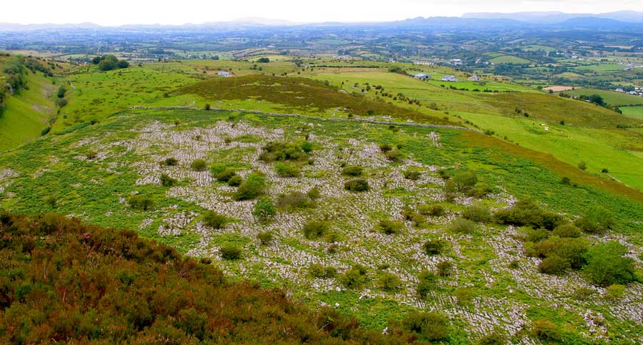
The Doonaveeragh house sites are at the same altitude as Shee Lugh, the neolithic cairn on the summit of the ridge of Moytura across Lough Arrow. The Mullaghafarna plateau is 226 meters above sea level, and has marvellous iews to the north and east. The western aspect is blocked by the higher ridge of Carrowkeel Mountain.

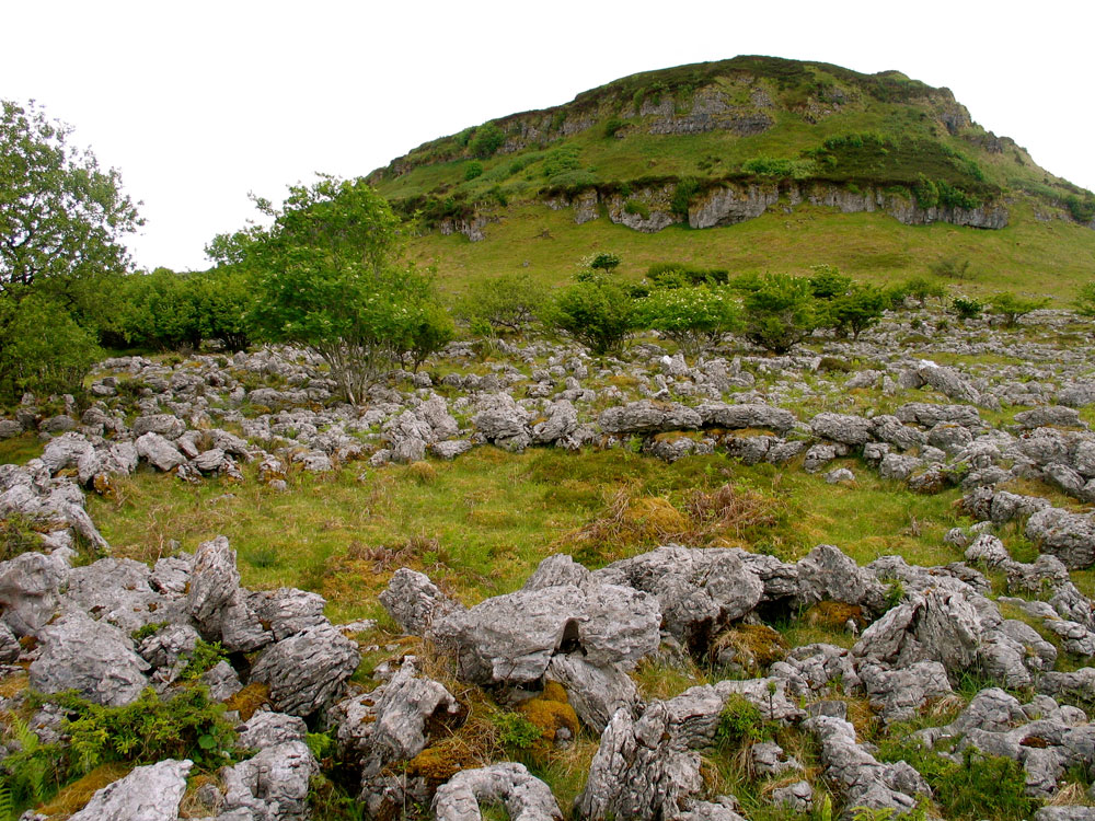
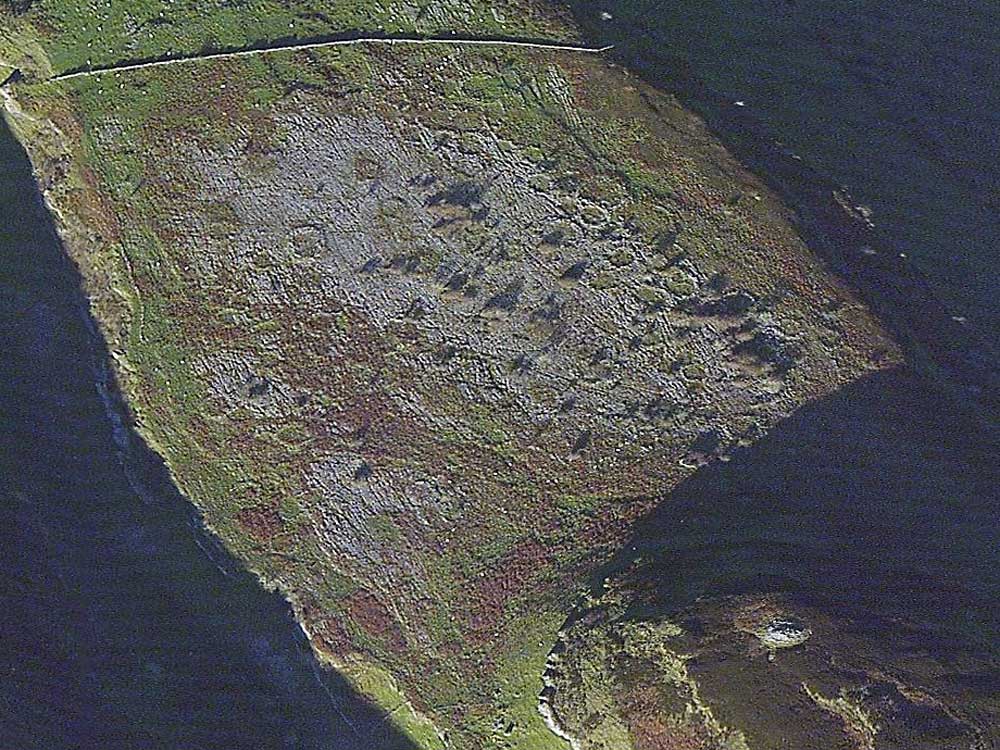
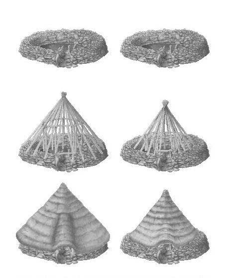
On this cracked and fissured limestone field, so similar in appearance to the Burren in County Clare, the remains of up to 153 house foundations have been surveyed. These sites consist of stone rings like small cashels ranging in diameter from 7 to 15 meters. These are the foundations of huts that would have had low stone walls, probably roofed with thatch onto a framework of saplings around a central pole. The largest of the circles are on the east side, overlooking the lake below.

Doonaveeragh Mountain.
View of Doonaveeragh Mountain and the Lough Arrow landscape from Carrowkeel.
Photograph from the 1911 excavation, by William A. Green, © NMNI.

Megalithic Survey

On top of a plateau of exposed limestone pavement, at the lower North end of Doonaveeragh ridge. Rising abruptly from the South end of the plateau is the upper tier of the dissected ridge on top of which is a possible passage tomb (SL040-099----) and a cairn (SL040-100----). The sides of the ridge are formed of limestone cliffs and steep scree-covered slopes. To West, a gorge separates Doonaveeragh and the higher ridge of Carrowkeel.

A dense concentration of roughly circular stone-walled huts (diam. 7-15 meters) cover the full East-west width of the ridge. Clusters of conjoined huts intermix with huts more loosely linked by short stretches of walling or by intervening walled courtyards. In many cases the enclosing walls (Wth 1.2-1.5 meters) consist of an inner and outer face of slabs or boulders with a rubble core. In some instances construction appears to involve the quarrying of karst to create the interior while leaving some bedrock in situ to define the perimeter. Internal partitions and entrances flanked by large jamb slabs also occur.

Herity (1974, 157-8) suggested that this complex may have been a 'passage grave township' and notes that since many of the huts are covered with blanket bog a date of before 1000BC would be probable for the complex. About 24 huts are indicated on the 1914 OS 6-inch map while Macalister, Armstrong and Praeger (1912, 331-2) recorded 47. An aerial photograph (CUCAP, AJO 35) taken in 1964 shows c. 80 huts.

In the summer of 2003 a survey and trial excavations were carried out by Stefan Bergh, Department of Archaeology, NUI Galway, and some 152 huts were identified; a preliminary examination of the finds, which includes a plano convex flint knife, concave scrapers of chert, chert debris, pottery and bones, has led the excavator to suggest a Neolithic date for the complex (The Sligo Champion, 16-7-2003).

A similar complex of huts (SL032-013004-) has been identified on Knocknashee c. 22 kilometers to North-west (Norman and St Joseph 1969, 24-5).

The above description is derived from the published 'Archaeological Inventory of County Sligo' compiled by Ursula Egan, Elizabeth Byrne, Mary Sleeman with Sheila Ronan and Connie Murphy (Dublin Stationery Office, 2005). Date of upload: 18 January 2008.

Source.

Doonaveeragh hut site.

There are a few other possible prehistoric villages currently known, one on Knocknashee near Tubbercurry, aother on Turlough Mountain beside Sliabhcarran in the Burren.

Twenty-seven hut foundations were discovered above the south cliffs of Knocknarea during the surveys conducted by Swedish archaeologists working at Carrowmore and Culleenamore. Dr. Stefan Bergh conducted trial excavations at three of the Doonaveeragh house sites in 2003, finding sheep teeth, hazel nuts, and a flint knife.

The Priest's Stairs.

A hidden cleft in the cliffs below Carrowkeel is known locally as the Priest's Stairs; according to legend it was used as an escape route by a local priest during the Penal Times. In 1911, R. A. S. Macalister was shown a small mound of stones within the gap, locally known as the Priests Grave.

A view across Doonaveergah Mountain.
A view across Doonaveergah Mountain from the top of the cliffs before Cairns O and P, over the hut circles on the flat plateau of Mullaghafarna. The plateau points to Knocknarea mountain 24 km to the northwest. Knocknarea is flanked by Doomore and Croughan to the left and Sliabh Da Ean and Benbulben to the right.