Cairn E - Macalister's 1911 report.
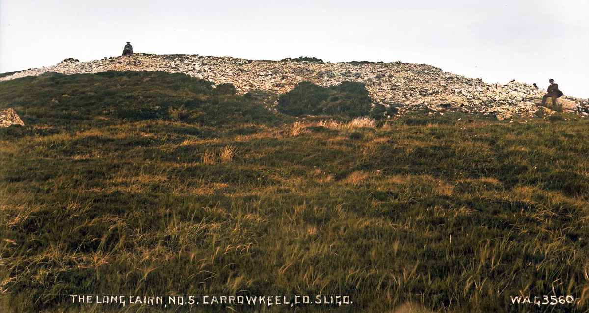
This remarkable structure is quite different from all the other carns of the series, though the general appearance of the building, and the scanty remains found within it, forbid our referring it definitely to a different stratum of civilisation, as we were at first inclined to do. It is a long, low mound (see Plate XII, fig. 1), 120 feet in length, and 35 feet in maximum breadth.
The height is about 8 feet in the middle, but it decreases at each end. The long axis lies about North-northwest and South-southeast. (the compass-bearing is 160 degrees). Traces of a kerb exist at the sides, as will appear from the plan (Plate XVII).
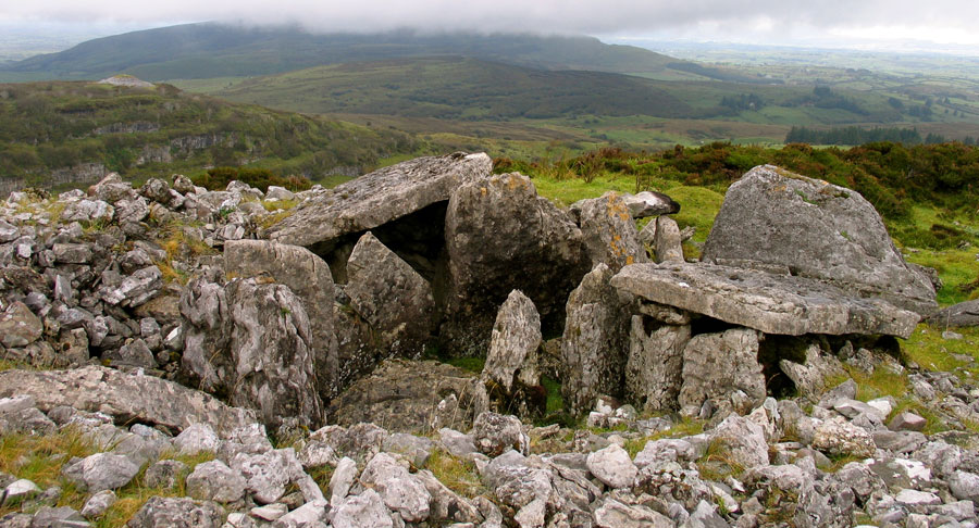
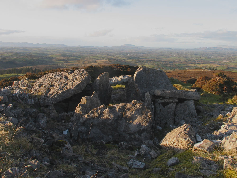
At the South-southeast end is an arrangement of large slabs on end, the disposition of which can scarcely be described in words. A glance at the plan will, however, convey to the reader a good idea of the arrangement. The large slab at the inner end is 12 feet long, 9 inches thick, and stands about 3 feet high. It is difficult to explain this structure: it is not like a ruined cist or chamber, but looks as though it had been intended to represent a large porch.
The horned long barrows, of which that at Uley is the typical example, are also distinctly recalled by this curious part of the carn. In any case, the "porch," if such it be, is blind, and the greater part of the carn consists simply of piled stones, as we proved by cutting several trenches across the mound.
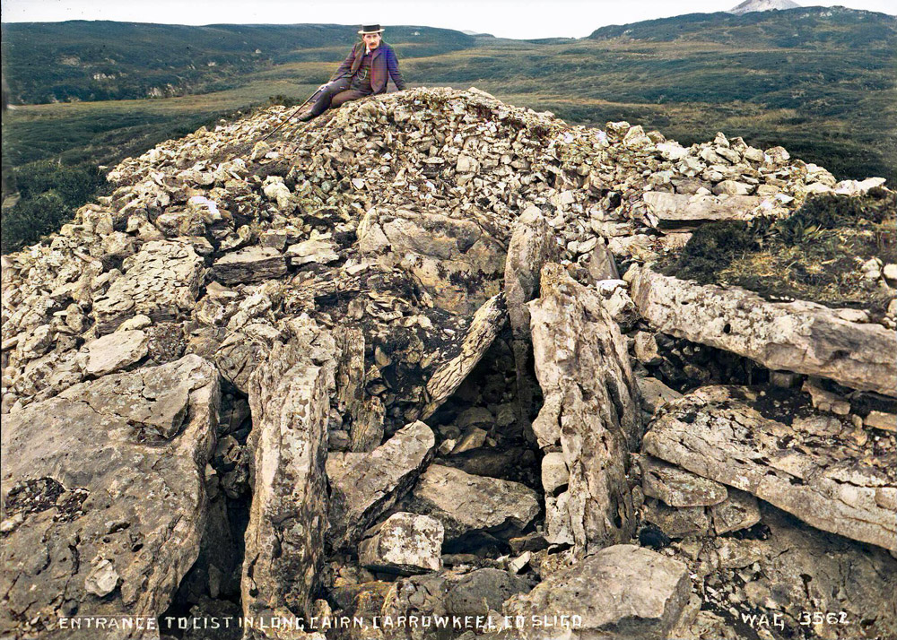
Just behind the porch, on the eastern slope of the carn, is a flagstone, 4 feet by 5 feet 6 inches, with some other stones underneath it, which has the appearance of being the cover-slab of a cist This we raised, but found no construction or deposit below. Only at the North-northwest end there is a small group of cists. This had long been open, and had fallen into ruin Plate XII, fig. 2, represents it in the state in which we found it.
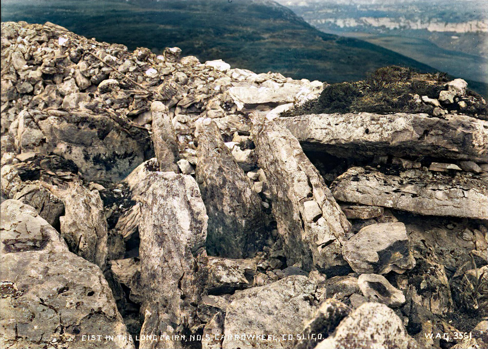
At first sight this looked a hopeless complication of debris, promising instructive remains nor even a satisfactory plan. But when we to clear out the floor, and then re-erected a couple of the side stones of the passage which had fallen forward, we had the satisfaction of recovering completely the original design, except at the entrance, where stones have apparently been removed.
A bed of peat, several feet thick, covered some parts of the existing entrance. This had neither proceeded accumulated after the structure had fallen into the condition of ruin in which we found it. There may have here been a porch-like structure of large slabs or stones, resembling that at the other end. The stones that seem to suggest this are represented on the enlarged plan on Plate XVII.
The chamber proper (which has lost all its cover-slabs) is a narrow passage, just under 12 feet long, and of irregular width, averaging about 3 feet. It is bounded by slabs of lime stone set on edge, four on one side, six (one of small size) on the other. The floor is divided by sill-stones, 6 to 8 inches high, into four compartments of unequal size, all of which contained the debris of interments.
The side-slabs are between 4 and 5 feet in height. On each side, at the second floor-compartment, is a small cist, formed, like the main passage, of slabs on end though smaller than the slabs in the passage and each covered with a large more or less rectangular slab, which still remains intact. These cists also contained bone debris, lying in each case on a large floor-slab. They are pentagonal in shape, the dimensions every way being about 3 feet.
The plan of a very similar structure, at Highwood, to the north of Lough Arrow, will be found in Wood-Martin's "Rude Stone Monuments of Ireland," page 181.