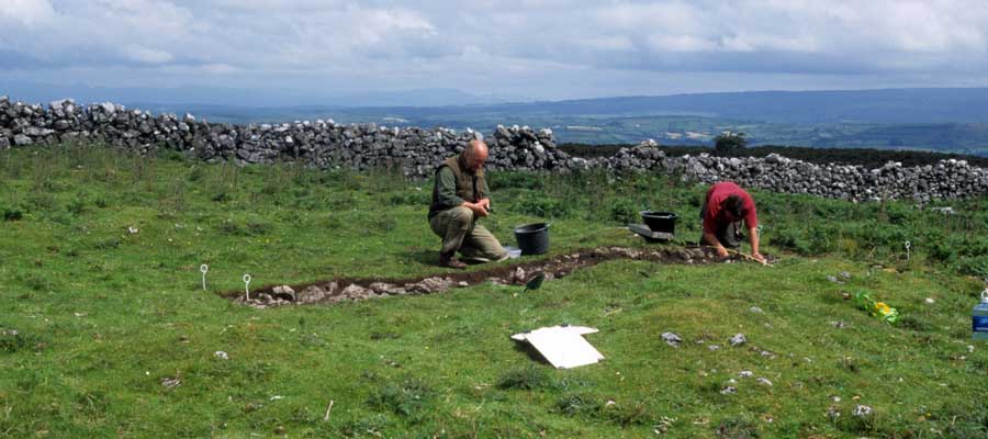
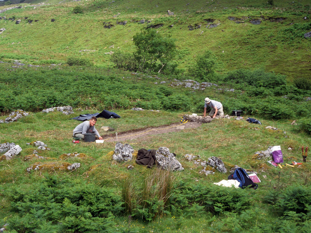
Stefan
Bergh and a student excavating a six by one meter trench across one of the
Doonaveeragh house sites in 2003.
Remains of a Settlement.
On the bare rocky platform to the north of the towering mass of Dun na
bhFioradh, occupying almost the whole area between that hill and the Mullach Fearna mearing, is to be seen a very remarkable group of circular structures.
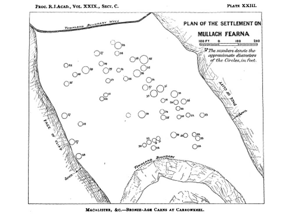
The plan given (Plate XXIII) shows their disposition: the numeral with
each represents the approximate diameter (ranging from 20 to 42 feet), as ascertained by pacing. The plan itself was made with the aid of a plane-table. Where enough of the structures remain to show details, they are seen to consist of two rings of upright slabs with small stone filling between, the walls thus made being about 3 feet thick.
They are ruined so completely that it is impossible to say where the doorways may have been. The forty-seven recorded on the plan are all of which we could be sure: some other rude groups of stone here and there were possibly the remains of others, but it
was impossible to be certain about this.
There is no trace of internal divisions. These enclosures were probably protecting walls within which were erected dwellings of some temporary nature—tents or huts. It is not at all improbable that they were the dwelling-places of the carn-builders: if so, those interesting structures may fairly claim to be one of the oldest village sites in northern Europe.
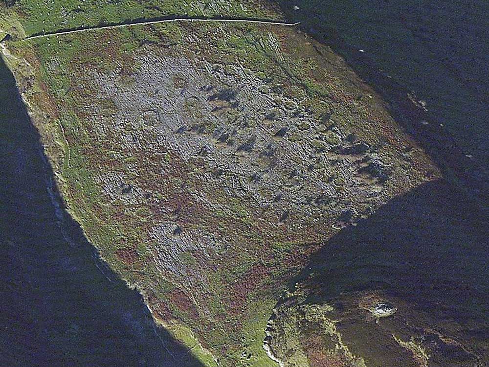
On account of the extremely rocky nature of the space on which these
structures stand, and the insignificant height and rough construction of the
structures themselves, it proved impossible to obtain a photograph that
shows any of them satisfactorily: the eye is unable to distinguish the circle of stones from the rocky background inwhich it is set. Several attempts were made, all, however, unsuccessful.
An idea of the general appearance of the
site is given by the two photographs (Plate XVI, figs. 3, 4). The first of these is taken across Upper Clar, from above Boithin an tSagairt, overlooking Dun
na bhFioradh with its two carns on the summit; to the left of the ridge is the rock-surface, on which are the circles.
The second view is taken from Dun na bhFioradh itself; and though not a very successful photograph, the circles can be clearly seen in it scattered among the rocks.
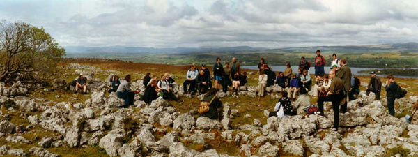
A
group of archaeology students visit one of the larger huts on the east
edge of the plateau.
Excavations at Doonaveeragh, 2003
The excavations at Mullaghafarna took place over a few weeks in early summer of 2003. The plateau becomes covered with bracken in late summer, and the hut foundations vanish until the autumn. Three huts were selected from different parts of the plateau and 6 x 1 meter trenches, or keyhole excavations were dug. From the NUIG website:
A high resolution survey of the plateau was carried out using digital photogrammetry. The survey was carried out by Robert Shaw and Anthony Corns, The Discovery Programme, based on imagery captured by BKS Ltd, Coleraine. This initial part of the survey identified 153 enlosures/hut sites on the plateau.
The second phase of the survey consists of the production of interpretative plans of each individual site. This work is extremely time consuming, as it involves extensive GIS analysis, followed up by detailed work in the field.
This work is in progress. With the main aim to establish the cultural context for the c. 150 enclosures/hut sites on Mullaghfarna, minor trial excavations were carried out in 2003.
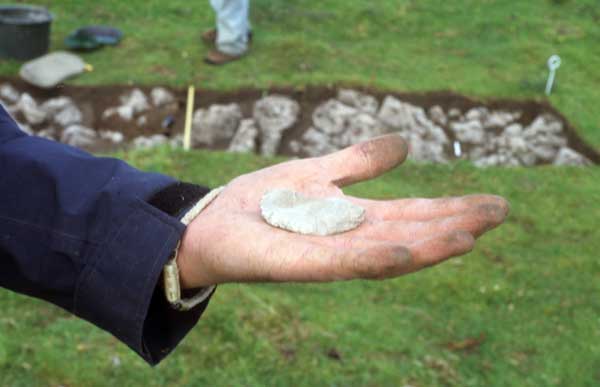
A flint knife, freshly excavated from the trench in the background. This piece came from Antrim and firmly dates the site to the neolithic.
All three sites excavated produced finds of Neolithic/Early Bronze Age date. All archaeological material had been washed down into the often deep fissures in the bedrock, leaving no material in situ.
To create a firmer chronological framework for the dating of the enclosures/hut sites, even though no material was found in primary contexts, ten radiocarbon dates (AMS) were processed from the sites.
The dating was performed by Centre for Isotope Research, Groningen, The Netherlands, and was funded by the Small Research Grant received from IRCHSS. The dates indicate both Neolithic and Bronze activity on the plateau.
Excavation of a Doonaveeragh hutsite in 2003.
The excavations proved a number of things. The hut foundations date to the neolithic and so were lived in by the people who built the cairns. This is show by the find of a fine flint knife of a type dating from about 3,200 BC. Like the megalithic chambers on the hill above, the houses were used throughout bronze age, which indicates that the same people lived here and continued using the site.
Another thing Dr. Bergh proved is that the pleteau was a smooth green field when the hut foundations were built, so the deep weathered karst of the plateau occured after the village was abandoned. This was shown by the lack of weathering or grykes under the walls.
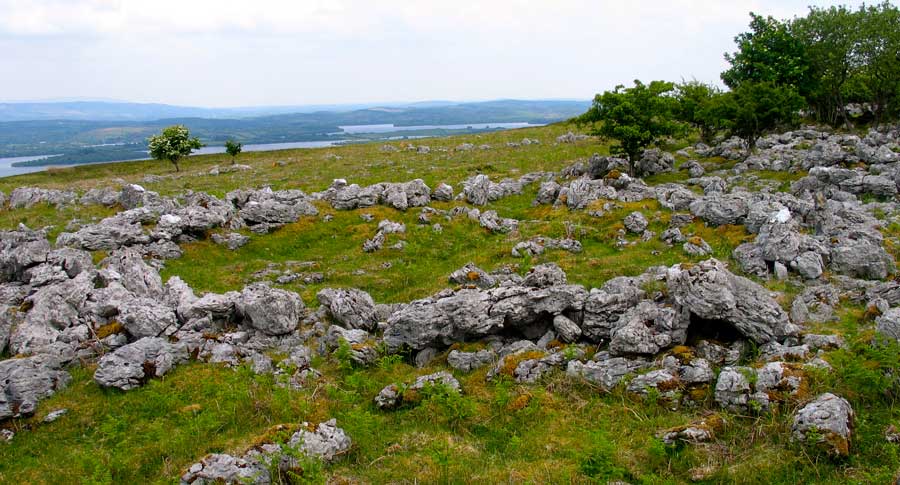
A large hut circle on the eastern edge of the plateau of Doonaveeragh. The fine view is to the south east across Lough Arrow to Sheemor.