Sites 46, 46a, 46b and 47
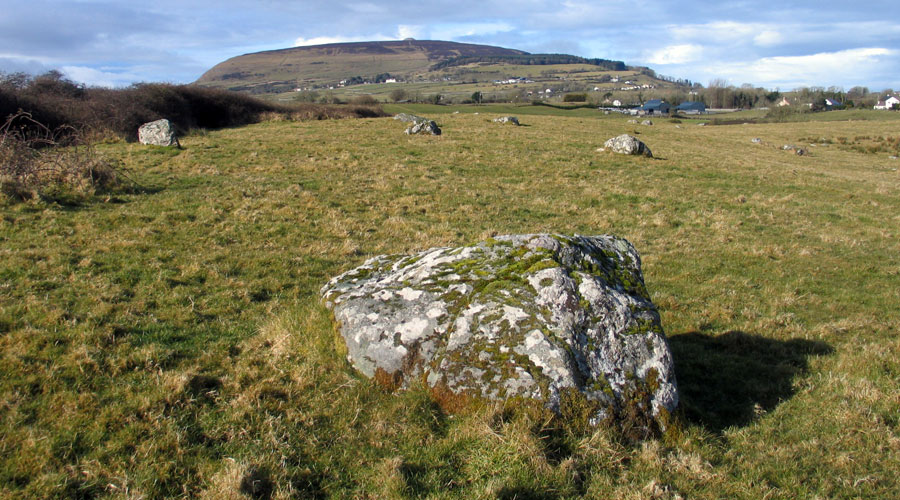
Monument number 46 is a ringfort with a diameter of thirty-six meters. Ringforts are not related to megalithic monuments, belonging to a much later period in time, generally dating from the early Christian to Medieval eras. They appear to have mainly functioned as defended homes for farmers, who may have had to bring their cattle in at night, to protect from wolves or thieves. County Sligo has one of the highest concentrations of coastal ringforts to be found anywhere in Ireland.
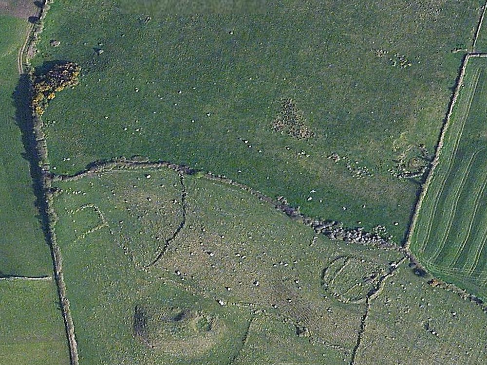
Monument 46a is probably a small hut foundation, which may date from any time between the stone age and the medieval, but is probably contemporary with the ringfort and related to the keeping of stock. There is a collapsed souterrain or underground storage passage within the eastern bank of the fort. In the aerial photograph above, medieval walls and banks are visible in the fields around the ringfort.
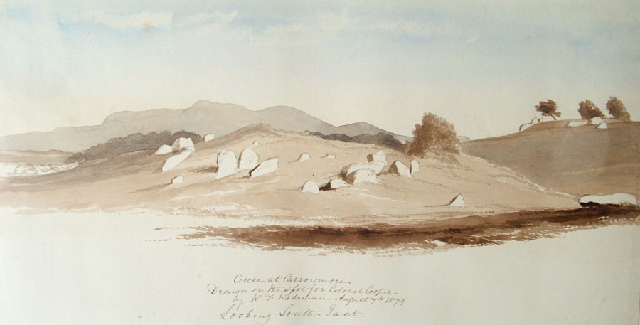
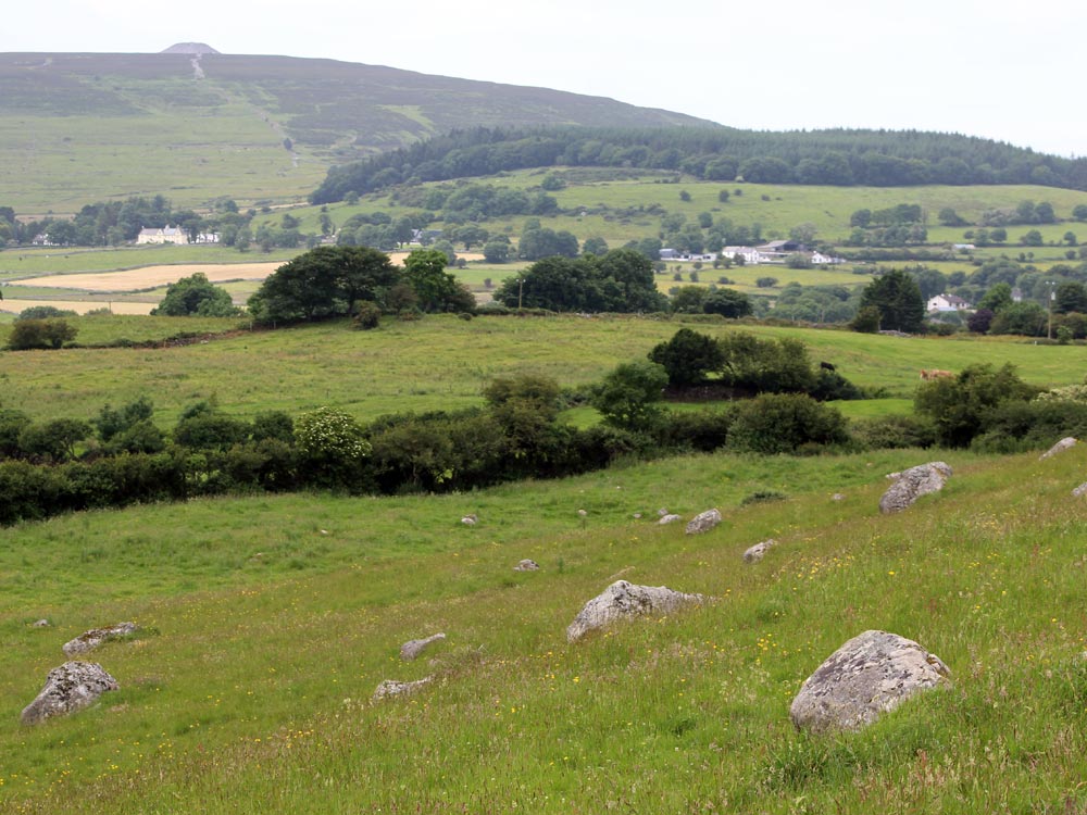
Petrie records that an unbroken chain of at least six circles was completely destroyed in this area around 1793. There are many stray and erratic boulders, and some thirty to forty have been gathered aound the south side of a wet area about 500 meters south of Listoghil. Certainly, when you look across the fence to the east, the field looks completely cleared.
No. 46
Situated in the next field to LVII, to the west, and
"close to the ditch which cuts off a portion of it."
- Petrie.
It is a few paces to the northwest of LVII (caltragh?).
"This circle appears rather to have been a cashel or fort than a place of interment. The diameter is about 120 feet, and the wall 10 feet in thickness. It is composed of enormous-sized stones mixed with earth, and has a ditch and bank surrounding it. It has also two smaller walls within it, and extending across it in parallel right lines, as see the plan."
- Petrie.
"This curious monument appears to have been originally rudely circular...... The circumvallation consists of an earthen rampart mixed with stones, and about ten feet in thickness. In the interior are two smaller banks extending across it in parallel lines. None of the enormous-sized stones which formerly composed the rampart now remain; but two boulders on either side of the gap in the south arc of the circle may perhaps mark the jambs of a rude entrance."
- Wood-Martin.
Circular earthworks divided by a bank traversing their interior area are known to German archaeologists.
No. 46 (a)
Near No. 46 (dolmen-circle). This is not noticed by Petrie.
"It is a very diminutive circle, ten feet in diameter, hollow in the centre, and surrounded by thin flags, ten in number. An excavation was made, but without result."
- Wood-Martin.
Colonel Wood-Martin compares it to a circle in Achill (co. Mayo').
No. 46 (b).
About one hundred and fifty paces to the south of No. 46 (Caltragh).
"A very similar structure to No. 46, not hitherto noticed" (and therefore not in Petrie's list). In common with No. 46, Col. Wood-Martin regards this as a sepulchral monument. It is not within the range of his map, but it makes the sixth monument of the class included in the Carrowmore group. Rude Stone Monuments, p. 66.
Site 47
No. 47. Situated immediately to the west of No. 46 (dolmen-circle, and at least 6 others).
"This circle is in part destroyed. About twenty stones remain. In the same field to the West there are a vast number of large stones (the boundary wall is in great part composed of similar stones); but it is impossible to trace, with any certainty, a circular arrangement among them. It is certain, however, that within the memory of the present inhabitants of the townland, the chain of circles was carried on without interruption through the great field immediately to the north.
They were destroyed by Mr. Walshe, who got a lease of the land from Lord Erne in 1793, to clear the ground. The peasants who were employed in their destruction remember six or more of them distinctly, and the stones of which they were composed still remain partly in pits within the field, and partly in the surrounding walls. In all these circles bones were found beneath the cromleacs. Towards the north of the field the series is again resumed."
- Petrie.