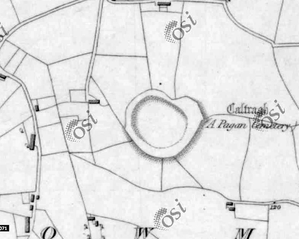
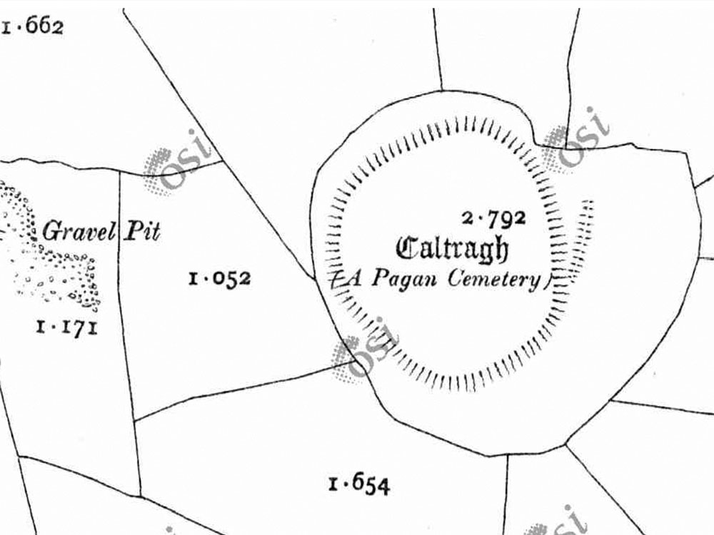
Carrowmore 60 - the Caltragh
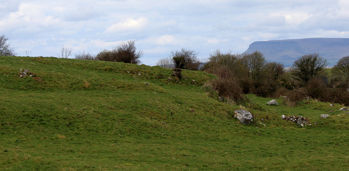
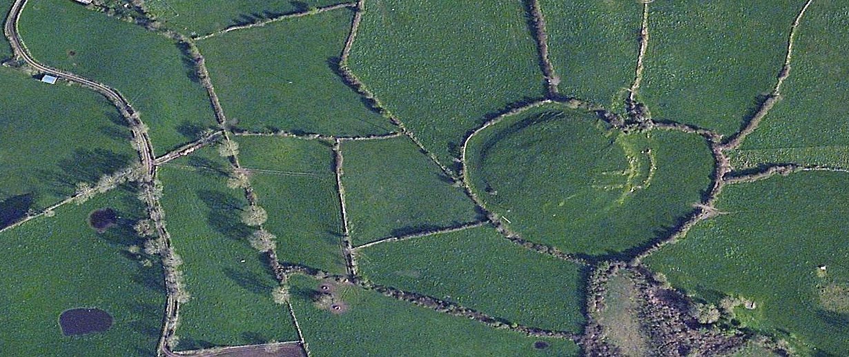
The Caltragh is a huge and impressive mound which may date to the iron age, found close to Carrowmore. The monument is not well known and is on private property. It was considered locally to be a pagan burial mound, and still has a mantle of awe and respect amoung the residents of the area. The monument is a huge earthen mound about ninety meters in diameter, and has never been excavated in modern times. Possible hut foundations have been identified on the mound.
Borlase - No. 60
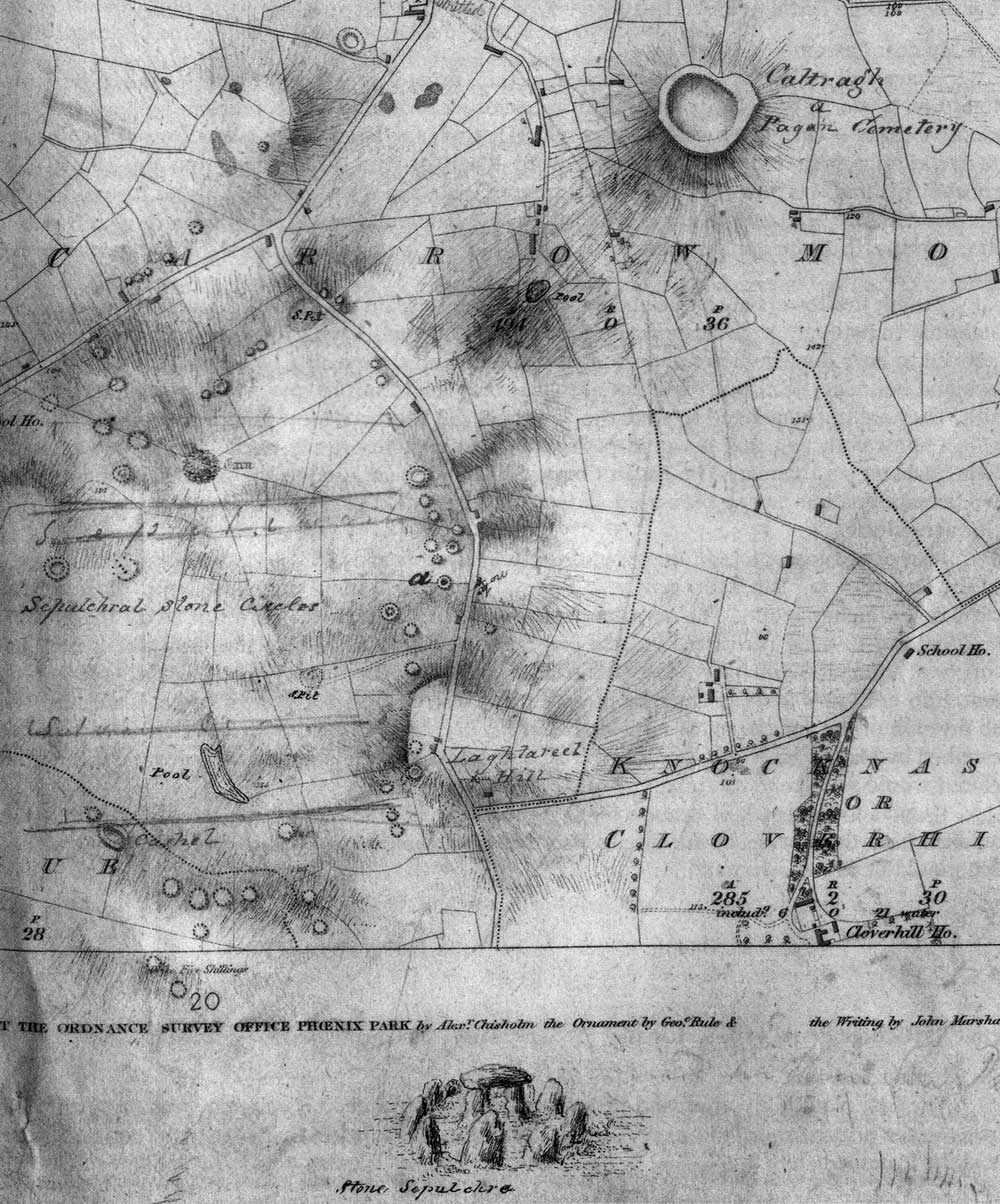
To the south of one of the roads leading from Sligo to Cloverhill, and east of that from Sligo to Seafield, northeast of the oval chain of circles.
"Known in the district by the name of Caltragh." Petrie here explains this term, as it was locally explained, no doubt, "the church or graveyard, from the fact that the whole of it is filled with human bones. No interment has ever been made in it in the memory of man, nor is there any tradition of a church ever having been there."
"It is evidently a work of pagan times, and the conclusion may, perhaps, be drawn with that, while the other monuments were the tombs of chiefs or princes, this was the general cemetery of the soldiers or common people."
- Petrie
Colonel Wood-Martin, in like manner, regards it as the general burying-ground for the ordinary population of the district, "as distinguished from the sepulchres within the circles, which would appear to be those of a family or of a chief."
"It is a great, circular enclosure (ninety-two paces in diameter from north to south, and about the same from east to west), originally surrounded, as in all the preceding examples, by a circle of large stones. Most of these stones have been removed to clear the land, and those which remain are nearly covered with earth."
- Petrie.
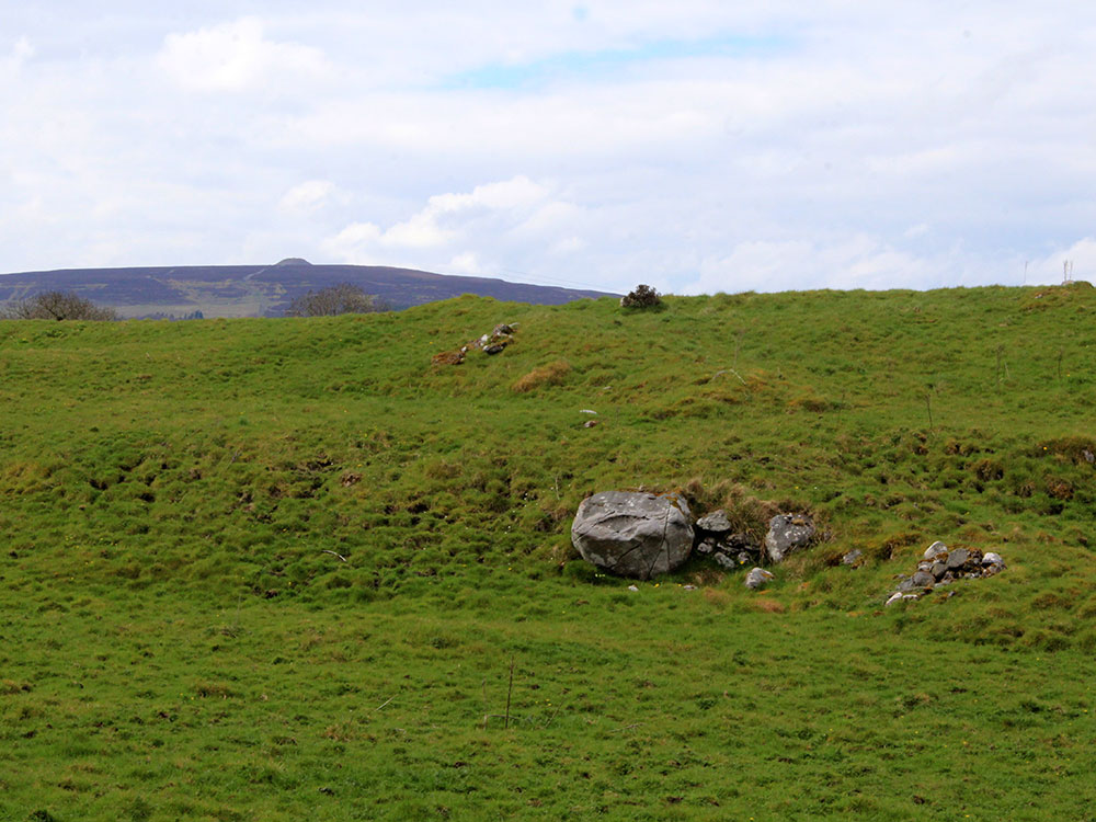
"The interior forms a gently rising hillock...... Owing to the quantity of human remains turned up when the grassy surface was broken for tillage, it is stated to have been soon again laid down by the tenant, who imagined the crop of potatoes would be too oily in taste! It is an enlarged and developed reproduction of No. 8.
Some years ago part of the field outside the periphery of the caltragh was tilled, and is said to have been full of human remains. In one small spot in the slope of the hill, from which the sod had been stripped by cattle, fragments of calcined and uncalcined bones, periwinkle shells, a fragment of fractured white quartz, and animal teeth, both calcined and uncalcined, were picked up."
- Wood-Martin.