Satellites at Knowth
Knowth is first mentioned by Sir Thomas Molyneux in 1726, when he seems to have participated in an excavation in what appears to be a satellite monument. Molyneux found a stone bowl or basin which he described as being–
enclosed in a square stone box, about five foot long and four foot broad, made of four rude large flag stones set together edgeways. The urn itself was one great heavy stone, of an oblong round figure, somewhat of the shape of the upper part of a man’s skull, but five or six times as large; ’twas of a sandy greet like freestone, but much coarser and harder; its length about sixteen inches, about twelve in breadth, and eleven in height, its cavity but shallow, not above five inches deep, rudely hollowed by cutting out some part of the stone, in which was found loose fragments of burnt bones: they seem to have taken pains in adorning the outside with rude lines and carving, yet the work shows more the labour than skill of the artist, who has graved five furrows one above another, round the upper part of the urn; and in the middle of each side, and at each end, rude figures, expressing, as I take it, the great luminaries of the world, the sun and moon: and I’m the more inclin’d to favour this conjecture, because ’tis sure, these two celestial bodies were very religiously adored by all of the northern nations in time of paganism.
The object, which he had illustrated, has long since vanished, but can only have been a basin stone, perhaps like the example found in Site 2. The first modern indication of satellite monuments at Knowth was noted by George Coffey in 1892, who thought boulders on the north side of the monument might indicate an entrance to the mound. R. A. S. Macalister, following up Coffey's suspicions examined the site in the 1941, discovering the monument known today as Site 14.
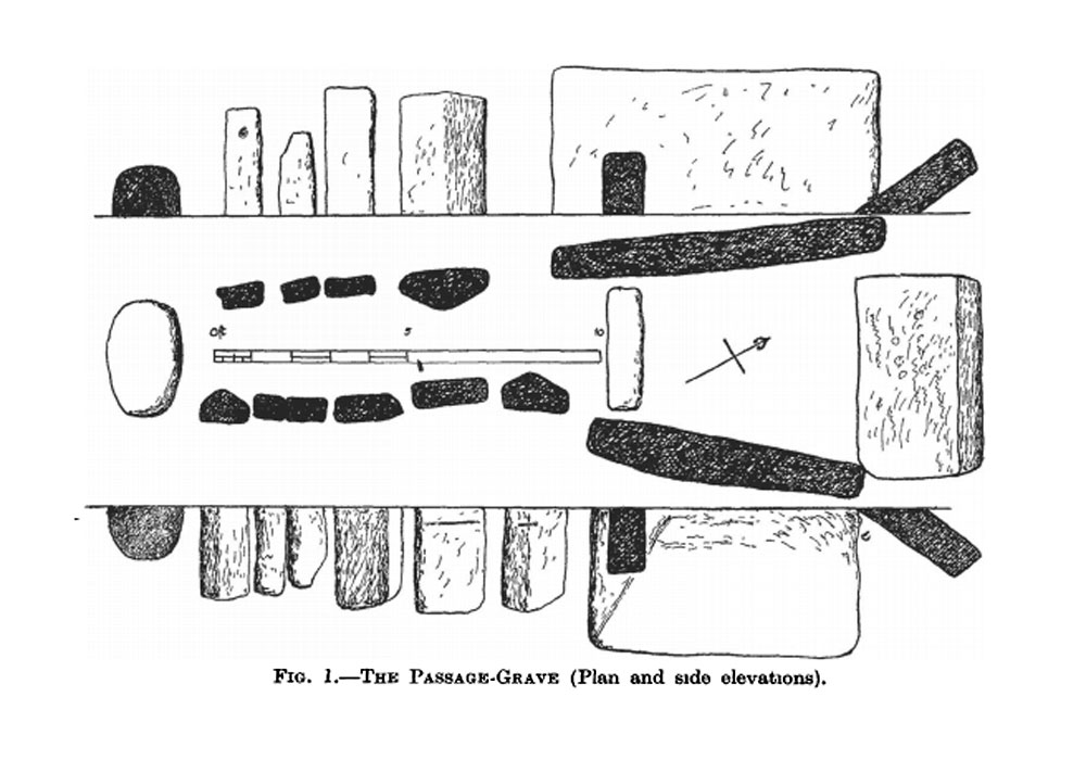
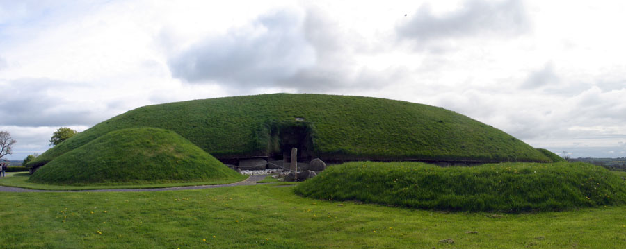
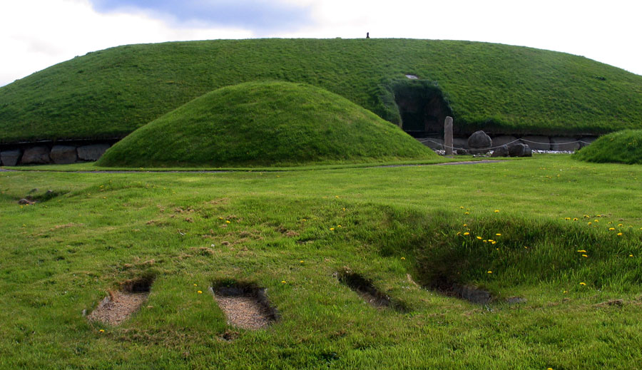
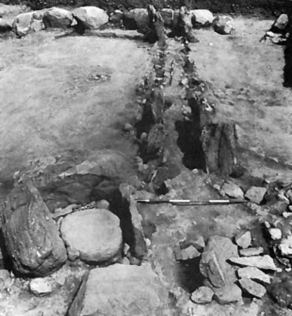
Macalister excavated the chamber of this monument, discovering that Site 14 is just over thirteen meters in diameter with twenty of the original kerbstones remaining. The kerbs are sitting on the old ground surface, and some have packing stones placed under them to keep the tops level. The passage and chamber measure 5.5 meters long, and are seperated by a sillstone. The chamber is two meters long, and the sides are formed by two massive slabs; a displaced capstone or corbel was also found on the site. The passage is aligned to the south-southwest. The passage shows signs of a fire having been lit in it at some stage.
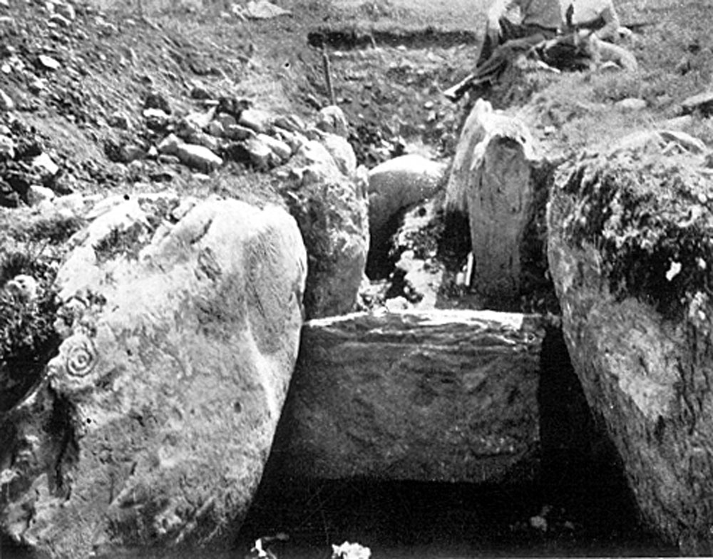
Macalister then proceeded to dig a trench south along the line of kerbstones looking for an entrance. He exposed fifty-eight kerbstones, forty-eight of which were engraved.
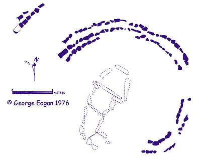
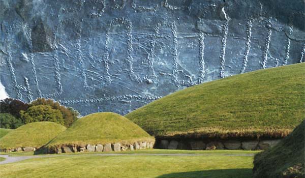
The major excavation and reconstruction of Knowth took place over forty years, beginning in 1962 and concluding in 2000. Professor George Eogan has devoted most of his archaeological career to excavating the site. The earlier phase of the excavations, from 1962 to 1967 concentrated on the smaller and most likely earlier monuments, and eighteen satellites were eventually discovered and excavated. In 1994 the remains of another monument, Site 20, was found in the disturbed area between Site 2 and Site 3. Though the site is mostly destroyed, the excavators believe the chamber was cruciform in shape.
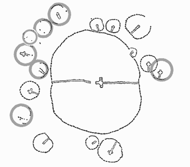
The satellite mounds range around the central mound on all sides and average about twelve metres in diameter, though the largest monuments (sites 2 and 15) are twenty to twenty-five meters in diameter. Several were too destroyed to make out much of their shape or plan, so they are indicated by circles on the plan of Knowth, above.
Several interesting things can be said about these satellites. The satellite monuments at Knowth are clustered around the main mound in a similar pattern to the much earlier arrangement found at Carrowmore in County Sligo, though there are twice as many monuments at Carrowmore. Many of the Knowth satellites are oriented inwards towards the main monument—the location of an inner, earlier pre-mound passage-grave. The satellites are certainly older than the main site, as at least two of them were altered to accomodate the kerb of the huge mound.
There are two kinds of chamber styles to be found in the satellite mounds, reflecting the two large chambers in the main mound. They range from simpler undifferenciated chambers within eight of the sites, five with cruciform chambers, and the remainder were too disturbed in later times to reconstruct their likely appearance.
Though it was assumed that all the monuments had cairns, the smaller monuments at Knowth may never have been covered with mounds. The earliest form of passage-graves in Ireland are tertres, free-standing burial chambers constructed on a round kerbed platform, like those at Carrowmore. Examples of tertres can also be found at Loughcrew and Carrowkeel.
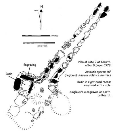
Many of the passages and chambers of the Knowth satellites may well have been oriented towards lunar events. Site 2 the largest of the Knowth satellite mounds is oriented towards the rising position of an extreme lunar position and is close to the midsummer sunset position. Others have speculated that the satellite monuments encode information in their reationship to the main mound.
During the reconstruction of the main mound, vast amounts of soil were removed from the area over the two passage-graves, in an effort to remove load-bearing stress. This material was replaced with lighter materials such as styrofoam and putty. The removed material was later used to reconstruct the mounds for the satellite monuments. In many cases, where orthostats or kerbstones were missing, they were replaced with concrete stumps.
Today it is difficult to know what to make of Knowth's collection of satellite monuments. They tend to be overlooked when compared to the huge mound with its impressive kerbstones and inner chambers. The supposed alignment of the East and West passages to the equinox sun rises and sets, which has been disproven, has tended to eclipse any research on the orientations of the satellites. The use of concrete and the obvious newness of the reconstructed satellites tends to make them appear as much more surreal than real monuments.